Unfortunately, I have not been able to run anywhere along the Baker Trail, ahead of my race on Saturday. I really don’t like going into races completely blind when it comes to the course route, so today, my wife and I decided to go and scout the course as best we could.
Obviously, scouting fifty miles of the course was out of the question, so we chose to drive to the location of each aid station. We made this decision for two reasons. Firstly, it will help my wife a lot on race day, as she is planning to meet me at the aid stations along the route. Secondly, each of the aid stations is located on a drive-able road, so it would be easy to reach them quickly today… or so we thought.
It turns out that cell phone reception is extremely poor in many of the areas where we went to today. We got lost on several occasions, as we were relying on Google Maps. Even with a downloaded map, we sometimes struggled. Eventually we found all but one of the locations, and we learned a lot of things that will help on Saturday.
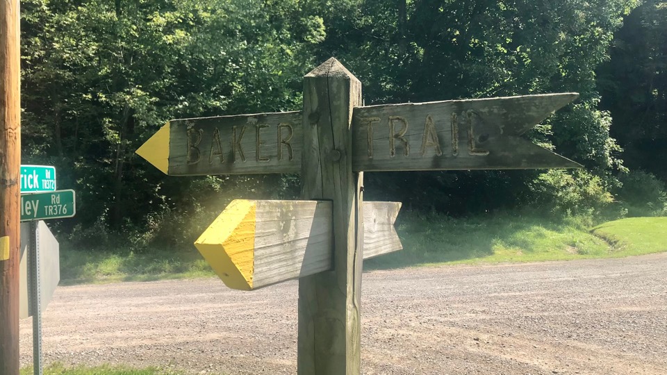
I was particularly pleased with how well the Baker Trail is marked. Whenever we were following the route on a road, the yellow blazes that mark the trail, were very visible. Turns were well marked with blazes or with custom made sign posts, like the one in today’s photograph.
I am glad we went out and did a bit of scouting today. It has helped me relax a little more heading into the big day.


